GPS Land Tools: Measure, Calculate, and Share Land Size and Price
GPS Land Tools is a versatile Android application developed by mojozoft. It falls under the category of Utilities & Tools and offers a wide range of features to measure land size and calculate land prices.
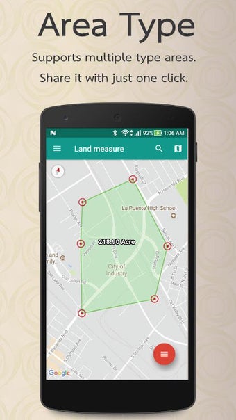
With GPS Land Tools, users can measure land size in various international units such as square meters, square miles, square yards, acres, square feet, square miles, and Thai units (Rai - Wah - Wah). The app also allows users to calculate the cost of land filling and share the image file of the measured area.
In addition to measurement capabilities, GPS Land Tools supports location tracking, making it easy to locate specific areas on the map. The app supports both Thai and English languages and offers landscape view for better usability. Users can also customize the area and volume units according to their preferences.
Overall, GPS Land Tools is a comprehensive Android application that provides essential tools for measuring land size, calculating land prices, and sharing measurements. It is compatible with all Android versions, making it accessible to a wide range of users.